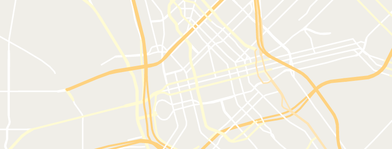
Road 
Zoom Level Applied: 5~19
The road(highway) is directly derived from the OSM highway hierarchy. It's the most complicated ones in Map Suite World Streets. The type of road is column "class".Some road has a column called 'oneway', which is used to access restriction on the roads as appropriate(when the way can only be used in one direction).
Some road examples: motorway, secondary, track, motorway_link, cycleway, etc. See more examples below.
Columns
geometry field
geometry type : line
class
The main field used for styling the ** is class.
the class attribute is the value of the OSM road "highway" tag's value, which helps indicate any kind of road, streets or path.
| Value | Description |
|---|---|
'motorway' |
A restricted access major divided highway, usually with 2 or more running path and plus a emergency hard shoulder. |
'motorway_link' |
The link roads (sliproads/ramps) leading to/from a motorway from/to a motorway or lower class highway. Normally with the same motorway restrictions. |
'trunk' |
A very important roads in a country's transportation system. |
'trunk_link' |
The link roads (sliproads/ramps) leading to/from a trunk road from/to a trunk road or lower class highway. |
'primary' |
Less important than 'trunk', but also very important in a country's transportation system which is usually link larger towns. |
'primary_link' |
The link roads (sliproads/ramps) leading to/from a primary road from/to a primary road or lower class highway. |
'secondary' |
The next important roads in a country's system which is usually link towns. |
'secondary_link' |
The link roads (sliproads/ramps) leading to/from a secondary road from/to a secondary road or lower class highway. |
'tertiary' |
Usually link smaller towns and villages. |
'tertiary_link' |
The link roads (sliproads/ramps) leading to/from a tertiary road from/to a tertiary road or lower class highway. |
'living_street' |
The residential streets that pedestrians have legal right over cars, low speed and children are allowed to play on the street. |
'unclassified' |
Usually be used for roads used for local traffic, and for connecting other towns, villages or hamlets. |
'service' |
Be used in conjunction to indicate the type of usage ,who can use it and in what circumstances. |
'pedestrian' |
Mainly used for pedestrians in shopping and some of them allow access by motorised vehicles only for very limited periods of a day. |
'residential' |
Roads often lead to housing and lined with housing. |
'road' |
An unknown type of road. |
'track' |
This tag represents roads for mostly agricultural use, forest tracks etc.; usually unpaved (unsealed) but may apply to paved tracks as well, that are suitable for two-track vehicles, such as tractors or jeeps. |
'lane' |
A lane is a route that lies within the roadway |
'raceway' |
A course or track for (motor) racing |
'cycleway' |
For designated cycleways. |
'bridleway' |
For horses. |
'path' |
A non-specific path. |
'construction' |
For roads under construction. |
'footway' |
For designated footpaths; i.e., mainly/exclusively for pedestrians. This includes walking tracks and gravel paths. |
'steps' |
For flights of steps (stairs) on footways. |
ref
ref stands for "reference" and is used for reference number or codes for the roads.
layer
layer: the values range from '-5' to '5'. It is usually related to tunnel and bridge. When 'layer' is range from '-5' to '-1', the tunnel often be '1'(it is a tunnel). And when the 'layer' range from '1' to '5', the bridge often be '1' (it is a bridge).
level
level: Indicates the floor level, can be used for roads that are tied to a floor level of a multilevel building.
oneway
A column of road, mark with "1" or "0" to indicate whether the motor traffic on the road is oneway or not. If the road is oneway, traffic travels in the same direction as the linestring.
tunnel
tunnel: Indicates if the roads are the 'tunnel'.
bridge
bridge: Indicates if the roads are the 'bridge'.
indoor
indoor: indicates if the roads are being inside a room, a building or a shelter.
z_order
z_order is used to describe vertical relationships between crossing or overlapping elements, e.g. a bridge over a street.
Data Download Source
| Zoom Level | Possible Values | Data Download Source |
|---|---|---|
| 5 | motorway | ne_10m_roads (scalerank<=4) |
| 6 | motorway | ne_10m_roads (scalerank<=6) |
| 7 | motorway, trunk | highway IN ('motorway', 'trunk') |
| 8 ~ 9 | motorway, trunk, primary | highway IN ('motorway', 'trunk', 'primary') |
| 10 | motorway, trunk, primary, secondary | highway IN ('motorway', 'trunk', 'primary', 'secondary') |
| 11~12 | motorway, trunk, primary,secondary, tertiary | highway IN ('motorway', 'trunk', 'primary', 'secondary', 'tertiary') |
| 13 | motorway , trunk , primary , secondary , tertiary , living_street , unclassified , motorway_link , trunk_link , primary_link , secondary_link , tertiary_link , residential | highway IN ('motorway', 'trunk', 'primary', 'secondary', 'tertiary', 'living_street', 'unclassified', 'motorway_link', 'trunk_link', 'primary_link', 'secondary_link', 'tertiary_link', 'residential') |
| 14 ~ 19 | motorway , motorway_link , trunk , trunk_link , primary , primary_link , secondary , secondary_link , tertiary , tertiary_link , unclassified , road , raceway , residential , living_street , pedestrian , cycleway , bridleway , path , construction , footway , steps , track , service | highway IN ('motorway', 'motorway_link', 'trunk', 'trunk_link', 'primary', 'primary_link', 'secondary', 'secondary_link', 'tertiary', 'tertiary_link', 'unclassified', 'road', 'raceway', 'residential', 'living_street', 'pedestrian', 'cycleway', 'bridleway', 'path', 'construction', 'footway', 'steps', 'track', 'service') |