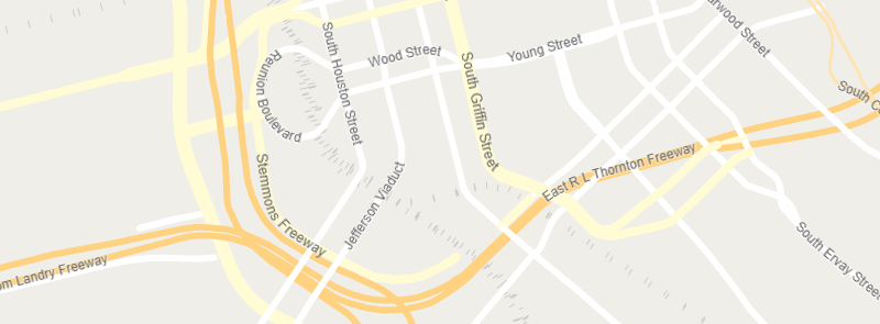
Road_name
Zoom Level Applied: 6~19
The railway is the lines which is used to represent the ways for many kinds of railways, including rail, narrow_gauge, subway, light_rail and construction.They started show up from zoom level 12.
Columns
geometry field
geometry type : point
name field
| Field | Description |
|---|---|
name |
The name (or names) used locally for the place. |
name_en |
English (if available, otherwise same as name) |
name_zh |
Chinese (if available, otherwise same as name) |
name_ar |
Arabic (if available, otherwise same as name) |
name_de |
German name name_deif available, otherwise nameor name_en. |
class
The main field used for styling the road_name is class.
| Value | Description |
|---|---|
'motorway' |
A restricted access major divided highway, normally with 2 or more running lanes plus emergency hard shoulder. Equivalent to the Freeway, Autobahn, etc.. |
'motorway_link' |
The link roads (sliproads/ramps) leading to/from a motorway from/to a motorway or lower class highway. Normally with the same motorway restrictions. |
'trunk' |
A restricted access major divided highway, normally with 2 or more running lanes plus emergency hard shoulder. Equivalent to the Freeway, Autobahn, etc.. |
'trunk_link' |
The link roads (sliproads/ramps) leading to/from a trunk road from/to a trunk road or lower class highway. |
'primary' |
The next most important roads in a country's system. (Often link larger towns.) |
'primary_link' |
The link roads (sliproads/ramps) leading to/from a primary road from/to a primary road or lower class highway. |
'secondary' |
The next most important roads in a country's system. (Often link towns.) |
'secondary_link' |
The link roads (sliproads/ramps) leading to/from a secondary road from/to a secondary road or lower class highway. |
'tertiary_link' |
The link roads (sliproads/ramps) leading to/from a tertiary road from/to a tertiary road or lower class highway. |
'tertiary' |
The next most important roads in a country's system. (Often link smaller towns and villages) |
'unclassified' |
The least most important through roads in a country's system – i.e. minor roads of a lower classification than tertiary, but which serve a purpose other than access to properties. Often link villages and hamlets. |
'road' |
A road/way/street/motorway/etc. of unknown type. It can stand for anything ranging from a footpath to a motorway. This tag should only be used temporarily until the road/way/etc. has been properly surveyed. |
'raceway' |
A course or track for (motor) racing |
'residential' |
Roads which serve as an access to housing, without function of connecting settlements. Often lined with housing. |
'service' |
For access roads to, or within an industrial estate, camp site, business park, car park etc. |
'cycleway' |
For designated cycleways. |
'living_street' |
For living streets, which are residential streets where pedestrians have legal priority over cars, speeds are kept very low and where children are allowed to play on the street. |
'pedestrian' |
For roads used mainly/exclusively for pedestrians in shopping and some residential areas which may allow access by motorised vehicles only for very limited periods of the day. |
'mini_roundabout' |
Similar to roundabouts, but at the center there is either a painted circle or a fully traversable island. |
'motorway_junction' |
Indicates a junction (UK) or exit (US). |
'give_way' |
A "give way," or "Yield" sign |
'emergency_access_point' |
Sign number which can be used to define your current position in case of an emergency. |
'crossing' |
A.k.a. crosswalk. Pedestrians can cross a street here; e.g., zebra crossing |
'bus_stop' |
A small bus stop. |
'bus_guideway' |
A busway where the vehicle guided by the way (though not a railway) and is not suitable for other traffic. |
'elevator' |
Elevator |
'construction' |
For roads under construction. |
'escape' |
For runaway truck ramps, runaway truck lanes, emergency escape ramps, or truck arrester beds. It enables vehicles with braking failure to safely stop. |
'track' |
Roads for mostly agricultural or forestry uses. |
'footway' |
For designated footpaths; i.e., mainly/exclusively for pedestrians. This includes walking tracks and gravel paths. |
'bridleway' |
For horses. |
'steps' |
For flights of steps (stairs) on footways. |
'path' |
A non-specific path. |
'passing_place' |
The location of a passing space |
'rest_area' |
Place where drivers can leave the road to rest, but not refuel. |
'speed_camera' |
A fixed road-side or overhead speed camera. |
'street_lamp' |
A street light, lamppost, street lamp, light standard, or lamp standard is a raised source of light on the edge of a road, which is turned on or lit at a certain time every night |
'services' |
A service station to get food and eat something, often found at motorways |
'stop' |
A stop sign |
'traffic_signals' |
Lights that control the traffic |
'turning_circle' |
A turning circle is a rounded, widened area usually, but not necessarily, at the end of a road to facilitate easier turning of a vehicle. Also known as a cul de sac. |
'User Defined' |
All commonly used values according to Taginfo |
ref
refstands for "reference" and is used for reference number or codes for the roads.
z_order
z_orderis used to describe vertical relationships between crossing or overlapping elements, e.g. a bridge over a street.
layer
layer:the values range from '-5' to '5'. It is usually related to tunnel and bridge.
level
levelIndicates the floor level, can be used for roads that are tied to a floor level of a multilevel building.
indoor
indoorindicates if the roads are being inside a room, a building or a shelter.
Data Download Source
| Zoom Level | Possible Values | Data Download Source |
|---|---|---|
| 6 | motorway ST_Simplify(geometry, 500) | highway = 'motorway' AND ST_Length(geometry) > 20000 |
| 7 | motorway ST_Simplify(geometry, 200) | highway = 'motorway' AND ST_Length(geometry) > 20000 |
| 8 | motorway, trunk ST_Simplify(geometry, 120) | highway IN ('motorway','trunk') AND ST_Length(geometry) > 14000 |
| 9~11 | motorway, trunk ST_Simplify(geometry, 50) | highway IN ('motorway','trunk') AND ST_Length(geometry) > 8000 |
| 12 | motorway, motorway_link , trunk, trunk_link, primary, primary_link, secondary, secondary_link, tertiary, tertiary_link, unclassified, road, raceway, residential, service,cycleway,living_street, pedestrian,mini_roundabout, motorway_junction, give_way,emergency_access_point,crossing, bus_stop, bus_guideway, elevator, construction, escape, footway, bridleway, steps, passing_place, rest_area, speed_camera, street_lamp, services, stop, traffic_signals, turning_circle, User Defined | ("rank"=1 OR "rank" is null) AND (name <> '' OR ref <> '') AND NULLIF(highway, '') IS NOT NULL AND highway NOT IN ('minor', 'track', 'path') |
| 13 | motorway, motorway_link , trunk, trunk_link, primary, primary_link, secondary, secondary_link, tertiary, tertiary_link, unclassified, road, raceway, residential, service,cycleway, living_street, pedestrian,mini_roundabout, motorway_junction, give_way,emergency_access_point,crossing, bus_stop, bus_guideway, elevator, construction, escape, footway, bridleway, steps, passing_place, rest_area, speed_camera, street_lamp, services, stop, traffic_signals, turning_circle, User Defined | ("rank"=1 OR "rank" is null) AND (name <> '' OR ref <> '') AND NULLIF(highway, '') IS NOT NULL AND highway NOT IN ('track', 'path') |
| 14~19 | motorway, motorway_link , trunk, trunk_link, primary, primary_link, secondary, secondary_link, tertiary, tertiary_link, unclassified, road, raceway, residential, service,cycleway, living_street, pedestrian,mini_roundabout, motorway_junction, give_way,emergency_access_point,crossing, bus_stop, bus_guideway, elevator, construction, escape, track, footway, bridleway, steps,path, passing_place, rest_area, speed_camera, street_lamp, services, stop, traffic_signals, turning_circle, User Defined | ("rank"=1 OR "rank" is null) AND (name <> '' OR ref <> '') AND NULLIF(highway, '') IS NOT NULL |